

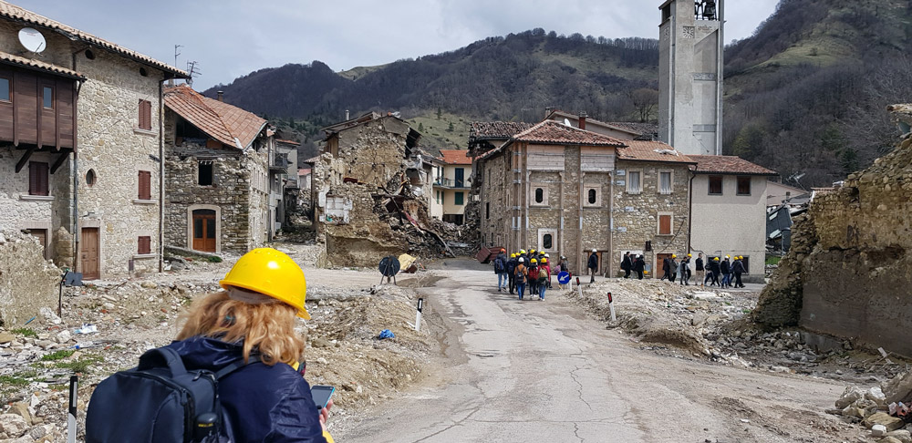
The Laboratory of Applied Geophysics is equipped with seismic and electromagnetic instrumentation for carrying out experimental measurement campaigns as part of scientific research activities in national and international projects, and for the technical-scientific support to the Public Administration (Civil Protection, Regions, Provinces, etc.) involved in programs for the mitigation of natural and anthropic risks.
Fully equipped lab spaces are available for planning and carrying out scientific experiments under controlled conditions, and for testing the functionality of sensors and geophysical instrumentation. In addition, the Laboratory houses a GPS sensor of the INGV’s RING network and is a reference node of the national gravimetric network.
The Laboratory is equipped with a Renault Trafic type vehicle and a Pick-up truck (GeoLab, under acquisition in the frame of the ITINERIS project) to support on-site geophysical measurements (transport, installation, and supply of geophysical instrumentation), even in emergency situations related to extreme events (e.g., earthquakes, landslides) for the characterisation and geophysical monitoring of subsoil, structures, and strategic infrastructures.
The geophysical instrumentation available to the Applied Geophysics Laboratory is the following: